01 ——
Vision 2030 Project Tracking
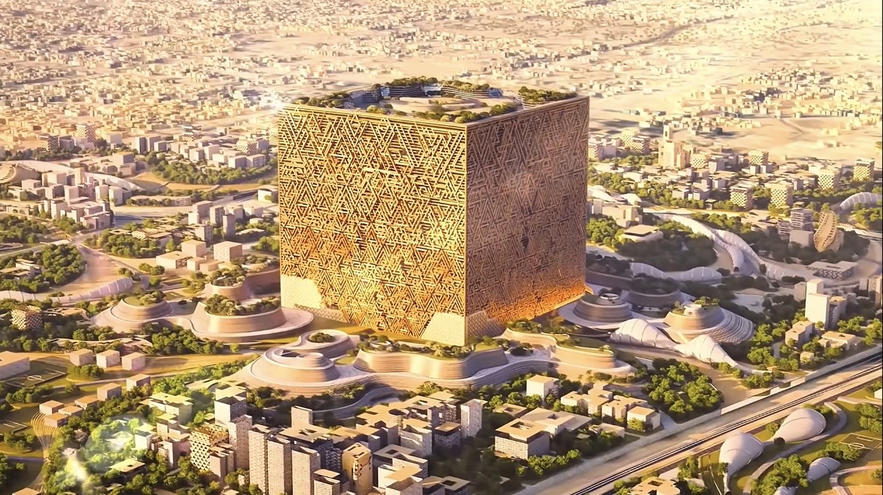
Track giga-projects, PIF investments, and NTP initiatives across their full lifecycle: planned → construction → operational.
 Loading…
Live Geographic Intelligence · KSA
01 — Platform Preview
02 — Data Coverage
03 — Core Capabilities
01 ——
Track giga-projects, PIF investments, and NTP initiatives across their full lifecycle: planned → construction → operational.
02 ——
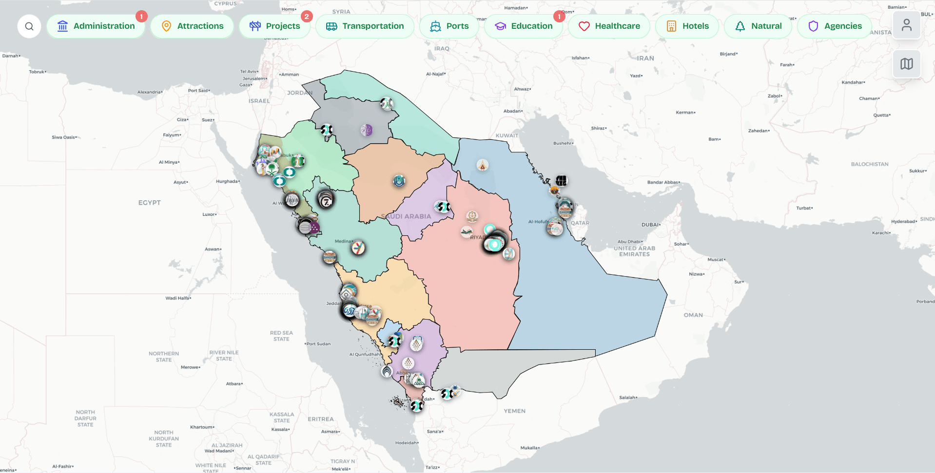
Choose from ten broad areas—flagship projects, cities, health, travel hubs, and more. Pan and zoom the Kingdom; what you see lines up with where you are looking, so the map stays easy to read at any level.
03 ——
Purpose-built for public-sector teams, businesses, and investors who need a single, reliable map of Saudi Arabia—without juggling dozens of separate sources.
04 — Vision & purpose
We built Wejhah as a single, map-first home for how the Kingdom is changing: giga-projects, initiatives, and their evolution—explorable in one place, with the depth to inspect, compare, and follow progress over time, not just read a list of names.
The core bet was to make national transformation visible in geography: turn layers on, zoom from a country view to project- and place-level detail, and use the same surface for discovery and context. The map is the product.
We layered in existing infrastructure, facilities, and related places alongside flagship projects so every major development sits in real-world context—how it connects to transport, services, and what sits around it—so you see the surrounding landscape, not an isolated pin.
Anyone who needs a credible, map-grounded view of Saudi Arabia in motion:
The map exists to make transformation legible in space and time—and open to everyone with a stake in the Kingdom.